Maps
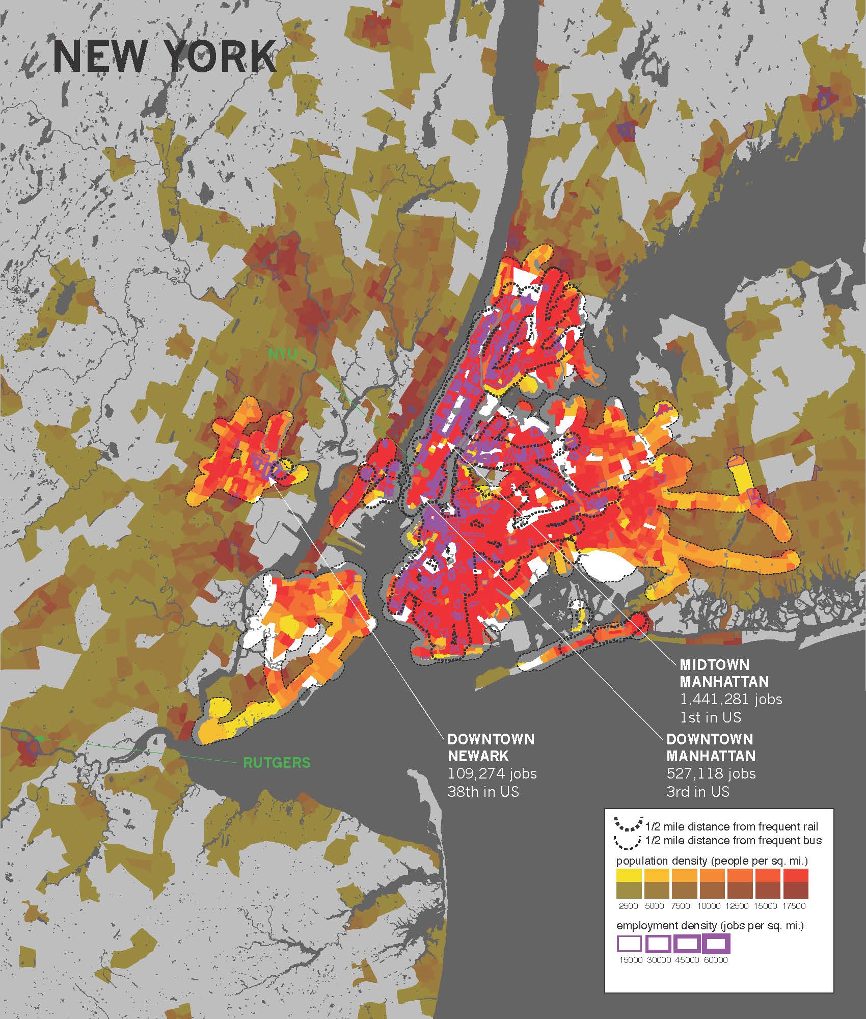
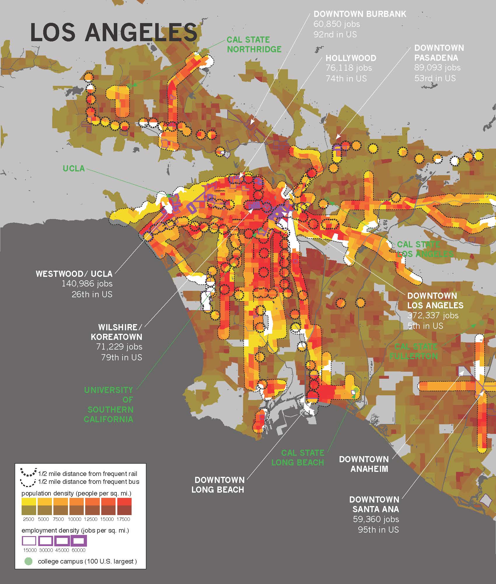
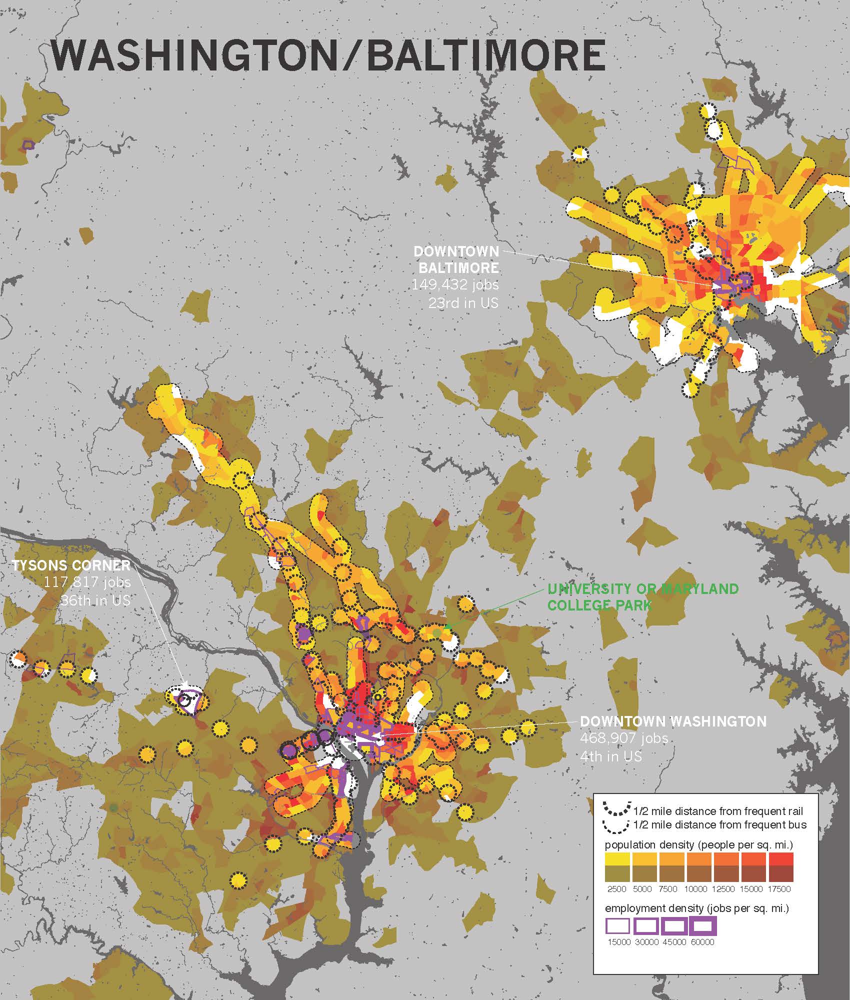
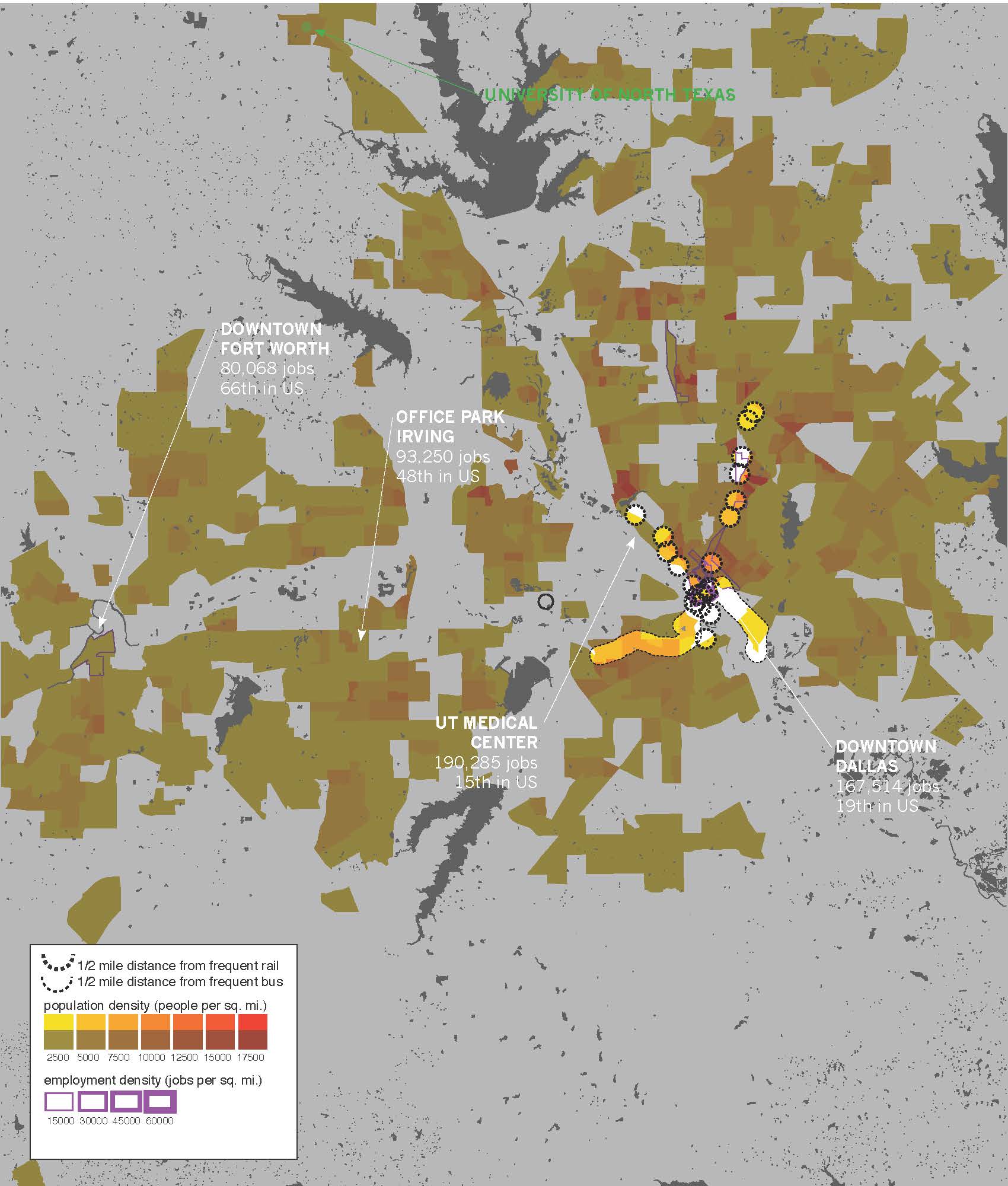
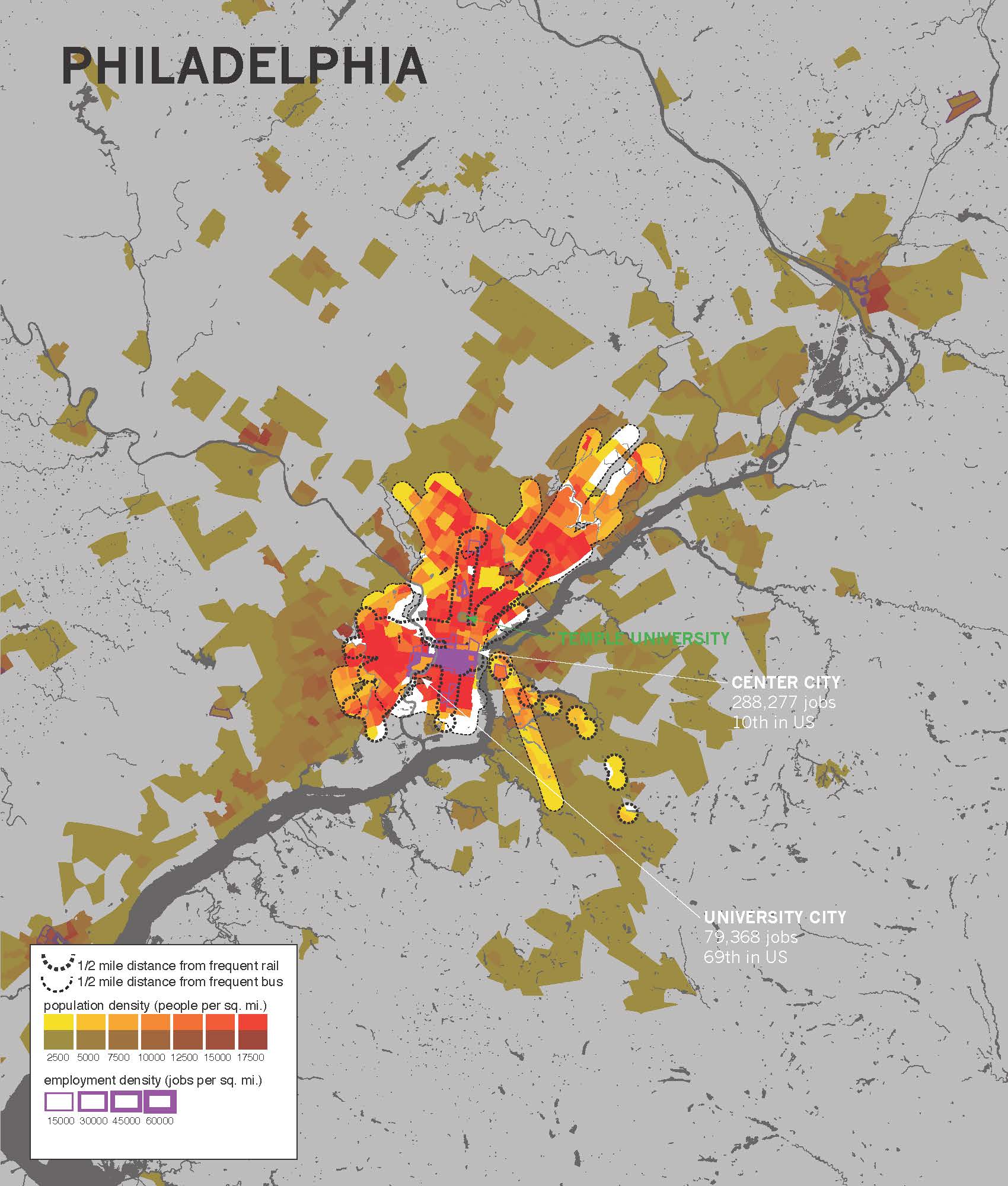
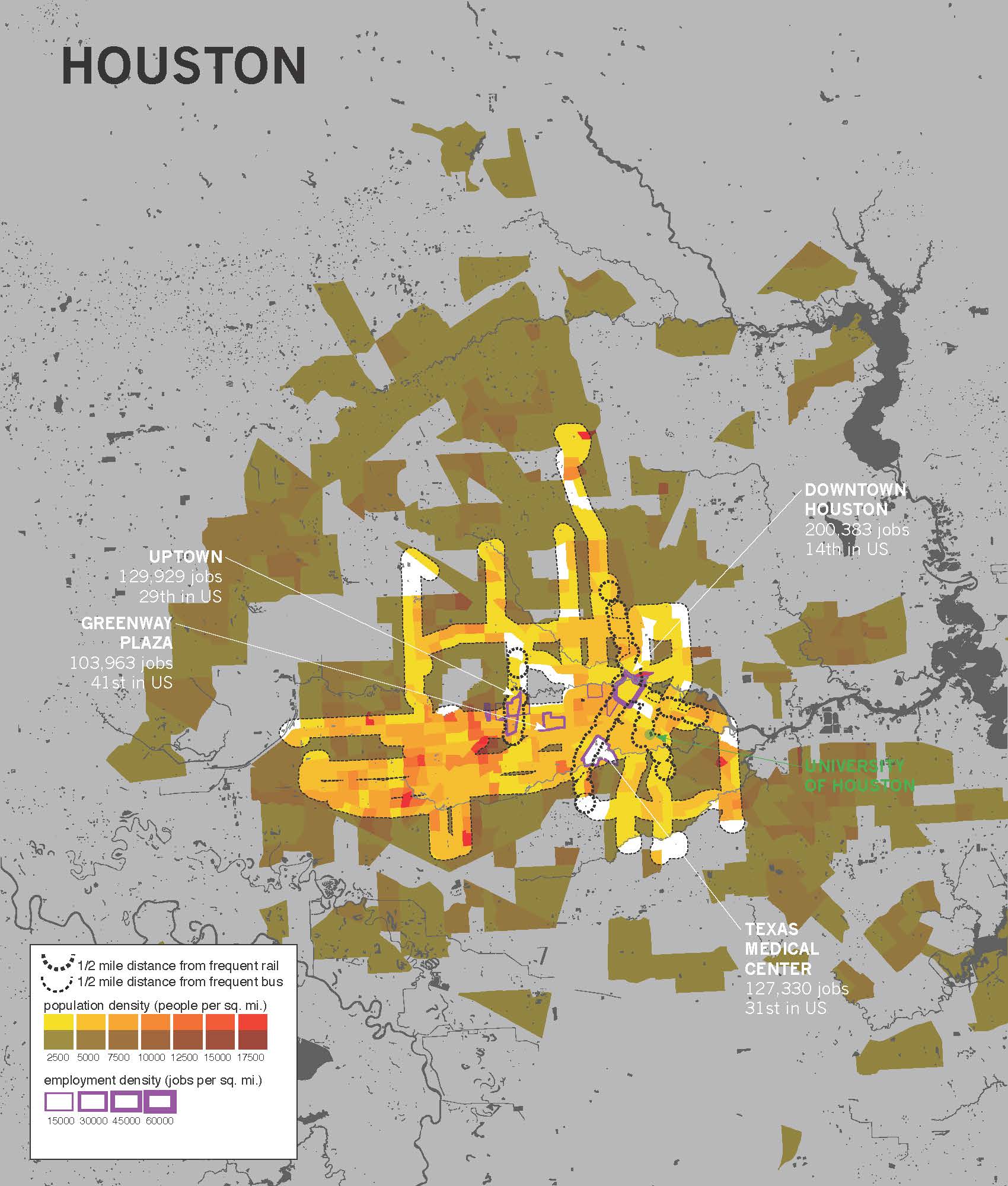
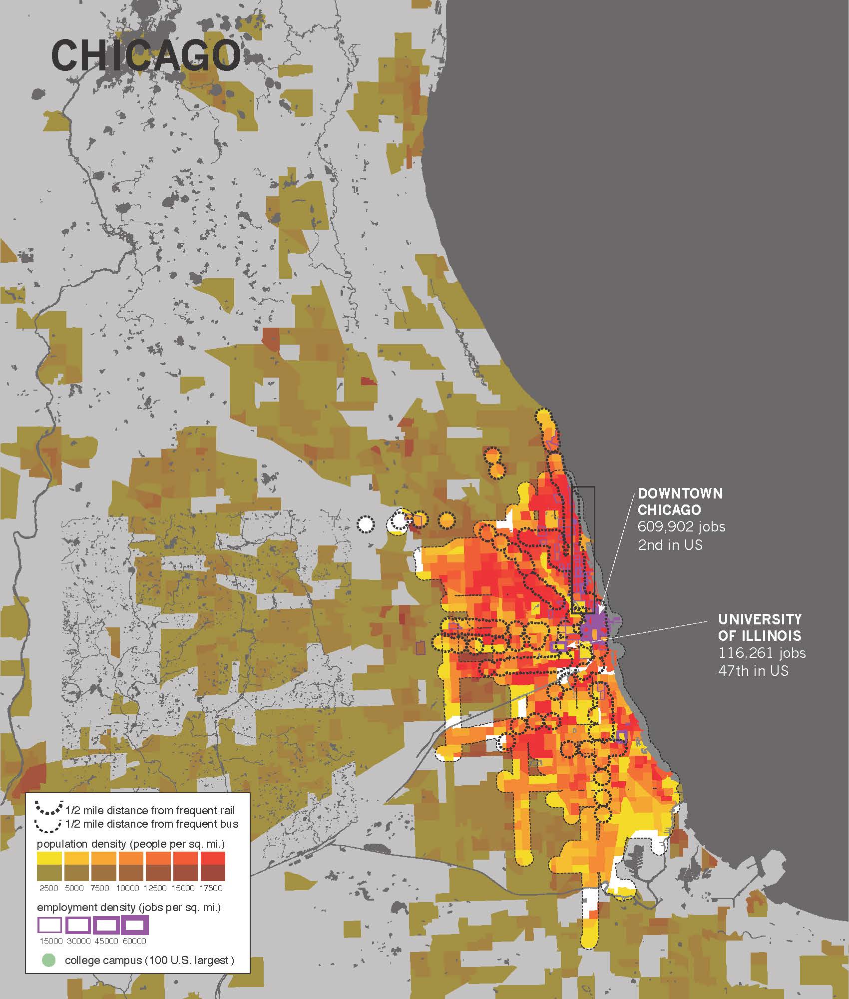
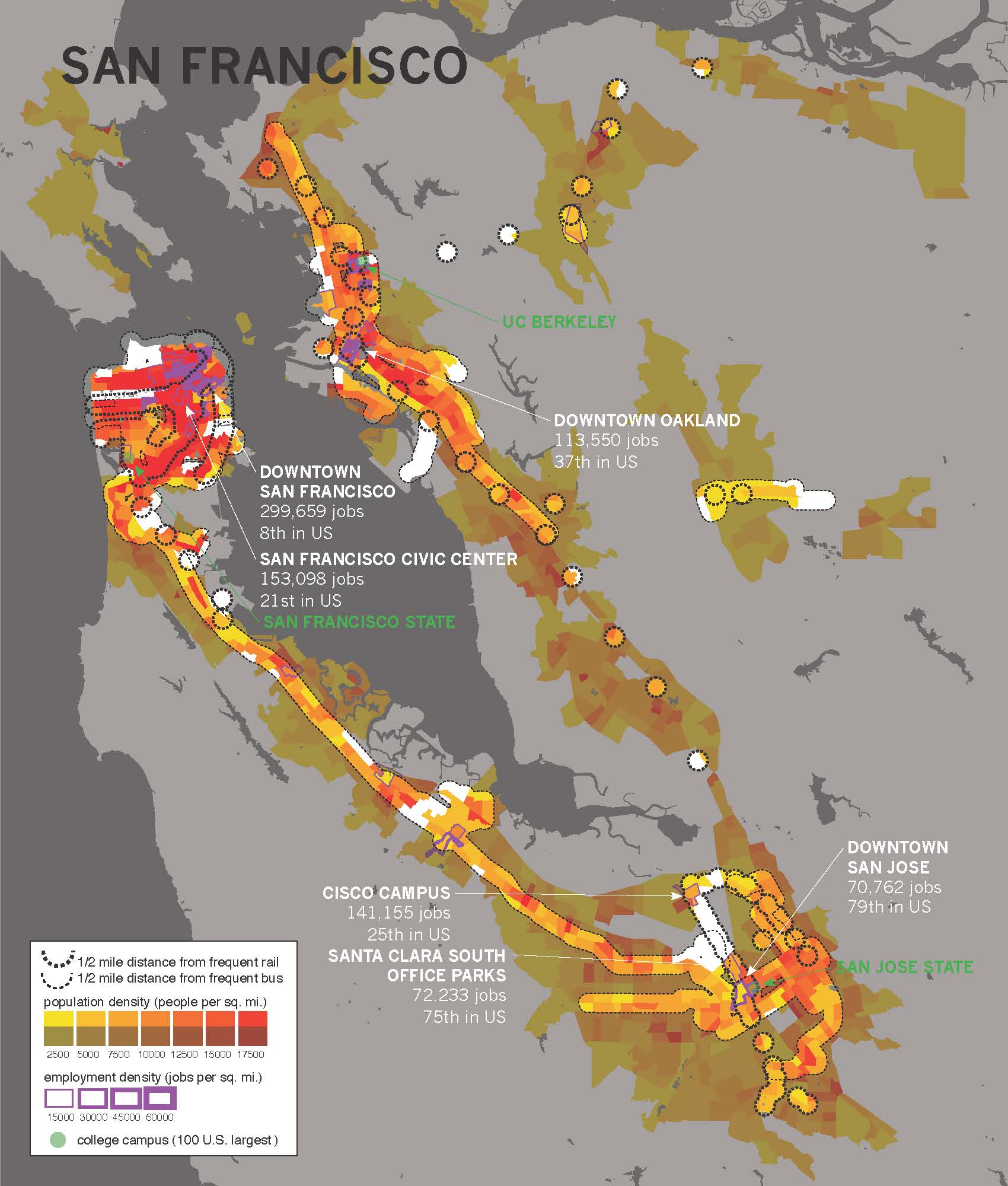
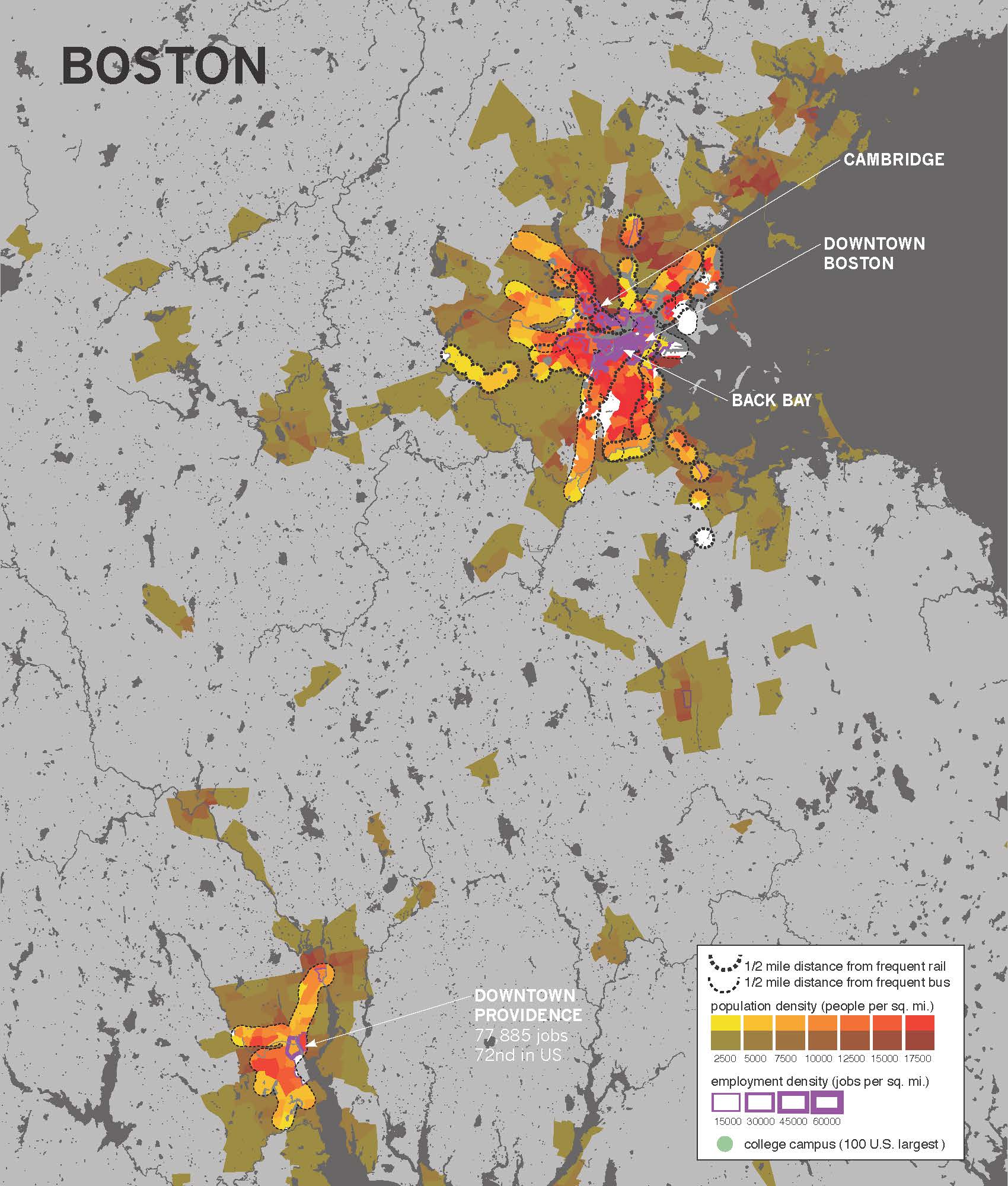
The book includes maps of every metro area in the United States that has rail transit or BRT. All the maps are at the same scale so it's easy to compare different cities. Here are some of the maps that show the parts of each metro area served by frequent transit -- buses or trains that run every 15 minutes or better from morning to early evening, 5 days a week -- overlaid on density. Its notable how different the scale of these systems are even in similarly sized metro areas, and how many dense areas are not served by high quality transit.